
Braintree Neighbors Around a Block
A Braintree block search is a Braintree parcel-and-record exercise. Begin with one Braintree address, identify the immediately adjoining or nearby Braintree parcels, and then keep Braintree owner, parcel, and historical-household evidence in separate columns. The public Braintree map can establish a spatial relationship. The Braintree assessor can identify the assessed owner and parcel facts. The annual Braintree Resident Street Listing Book can provide a dated street snapshot. None of those Braintree sources is a live list of everyone at every address, and Massachusetts does not publish a general voter street roster.
| Source | What it shows about a block | Access |
|---|---|---|
| Braintree ArcGIS parcel layer | Braintree parcel polygons, MAP_PAR_ID and LOC_ID relationships | Public Braintree map and feature-service layer |
| Braintree Patriot assessor | Assessed owner, situs, Braintree parcel characteristics, sale and book/page fields | Free public Braintree parcel search |
| Norfolk deed index | Recorded Braintree land parties and instruments for a specific parcel trail | Braintree name-and-town index; separate Land Court path |
| Braintree Resident Street Listing Book | A name listed at a Braintree street address in a particular annual census cycle | Braintree Town Clerk printed-book route |
| Braintree historic street-list directory | Past Braintree printed names and addresses, with village labels | Braintree Thayer and State Library collections |
| Braintree Town Resource Directory | Braintree community institutions and public organization context | Official Braintree searchable directory, not a resident roster |
Use the Braintree parcel relationship first, then decide whether the Braintree question is title, a dated household listing, or local context. A Braintree map label is not proof that a person uses a property. A Braintree property record can name a trust, estate, organization, or an owner whose mailing address differs from the parcel’s physical location.
Braintree Neighbors on Parcel Maps
The Town’s Braintree GIS hub and public Braintree parcel layer make the adjacent-parcel method reproducible. The Braintree layer contains polygon geometry and fields including MAP_PAR_ID and LOC_ID. LOC_ID relates to the Braintree assessor table, which provides the bridge from Braintree map orientation to parcel research. The service supports spatial queries and has a public maximum record count of 2,000. Its geometry and attributes were refreshed in December 2023. Braintree parcel lines remain a representation, not a legal survey.
- Locate the known Braintree address in the municipal GIS and note the Braintree parcel’s MAP_PAR_ID and LOC_ID where available.
- Click or identify the immediately adjoining Braintree parcels rather than expanding the search to a whole neighborhood.
- Use each Braintree parcel identifier or street address in the Patriot assessor search, keeping the assessed owner and physical situs separate.
- When Braintree title history matters, search the recorded party in the Norfolk Registry and compare the legal description with the mapped parcel.
- For a full named-street chain rather than one block, use the Braintree street directory records workflow.
The following official Braintree parcel-layer capture shows the public spatial data source used for this Braintree neighbors method.
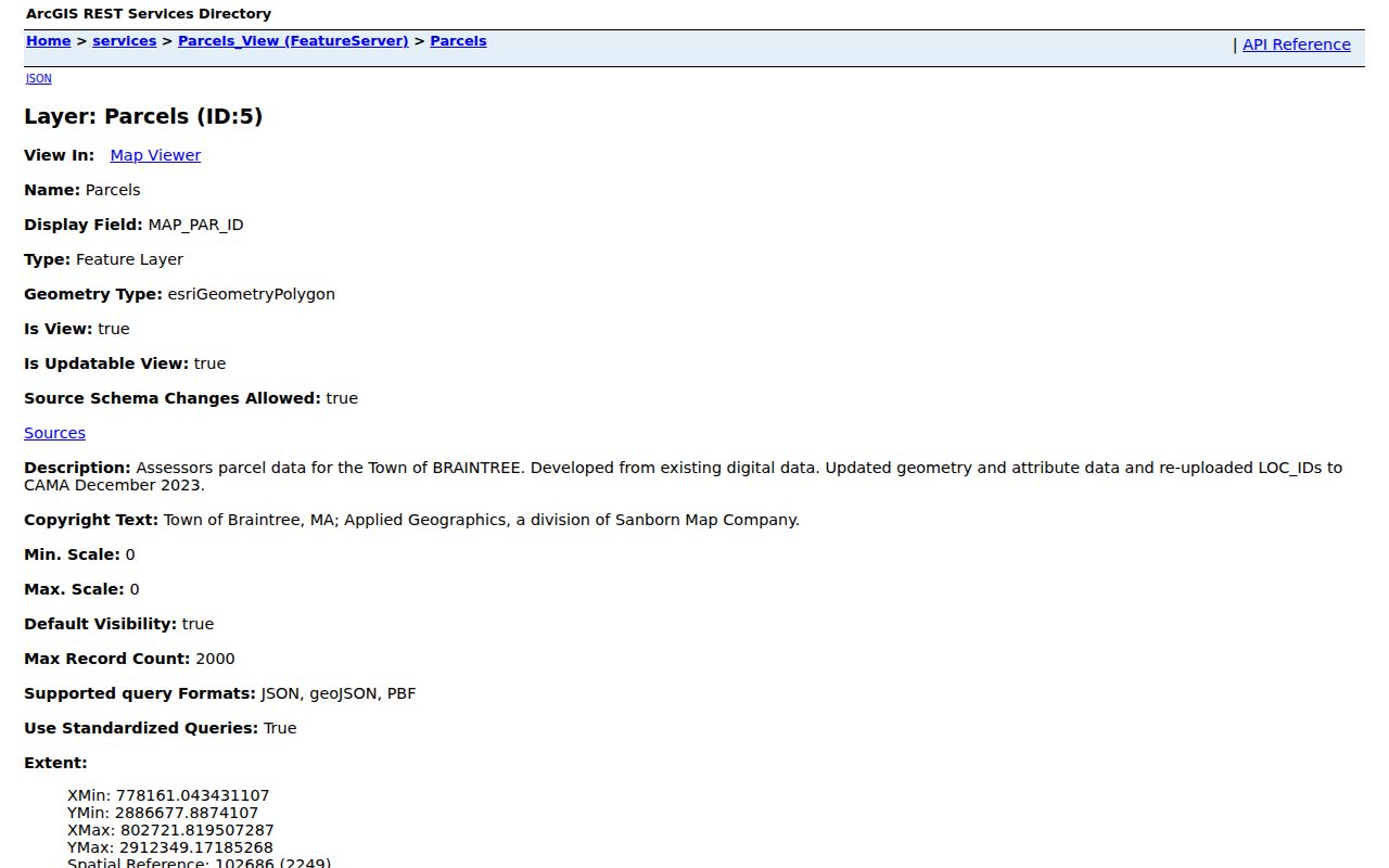
The image reflects a map-data service, so it should lead to a parcel check rather than a conclusion about people at an address. Consult the Registry for title and a surveyor for a legal boundary question.
Braintree Neighbors and Assessor Labels
The Patriot search accepts parcel, owner, street name, street number, value, physical-characteristic, sale, neighborhood or land-use-code, and book/page fields. For neighbors research, street name plus street number is the narrowest address start. The assessor result can show a current assessed owner and property characteristics, but it does not declare every current user of a property. Record the source date because ownership, values, and assessor data can change.
Keep four terms distinct: the situs is the physical parcel location; the owner of record is the name attached to the assessed parcel; a mailing address is the tax-bill destination if shown; and occupant evidence must come from a separate, appropriate source. A mailing address outside Braintree does not move the parcel outside town, and an owner may be a trust, estate, company, or several people. This distinction is central to accurate Braintree neighbors work.
When the map and assessor screen do not resolve an address, Town Engineering is the municipal fallback for addressing, building numbers, parcel and zoning maps, abutters, drainage and scanned engineering records. The department assigns new addresses and address changes, and the research identifies a Street Number Application route. A request for one address or one parcel is more likely to produce a usable response than a request for an undefined area. Save the response with the map and assessor search date so later changes remain visible.
Braintree Neighbors in Street Snapshots
The annual Resident Street Listing Book is Braintree’s public-facing local layer for a dated street question. The Town Clerk says the annual census is reflected in the book, updated books are published each August, and copies are sold throughout the year. A listing can show that a name appeared at an address during that census cycle. It cannot establish ownership, a current presence, citizenship, or voting eligibility. Use it alongside a parcel or deed record when the distinction matters.
Braintree sends a census or registration confirmation to the head of household each January. The Town Clerk notes that an active voter may become inactive if the form is not returned, which is another reason to treat the street book as a dated administrative snapshot. Ask the Town Clerk about a specific book year, whether it may be viewed onsite, and the access status of the requested material. For an older street question, a precise year and address are far more useful than an open-ended request for all names.
The Secretary of the Commonwealth’s voter tool is different. It requires first name, last name, date of birth, five-digit residential ZIP, and an agreement checkbox for an individual status search. M.G.L. c. 51, § 47C limits general release of central-registry name and address data, and no public by-street voter file was found. Polling places and precinct groups describe civic geography, not who voted or where a person lives.
Braintree Neighbors in Civic Groups
Community resources add block context without becoming a people list. The official Town Resource Directory has category and name search controls, an A–Z option, and paginated results. It surfaces historic resources, houses of worship, youth sports, town resources, elder affairs, and other public organization categories. The research found examples including Braintree Art Association, BCAM, Braintree Community Youth Center, BELD, and Braintree Historical Society. These listings document institutions, not their members or every nearby household.
| Community resource | Public-facing value | Boundary for neighbor research |
|---|---|---|
| North Braintree Civic Association | Neighborhood advocacy and public-meeting context | No public member roster was located. |
| Braintree Historical Society | Maps, town files, clubs, schools and historic-property context | Archive holdings are not a current resident list. |
| BCAM and community organizations | Public organization and civic-resource context | Use the official directory result, not a claim about individuals. |
| Town Resource Directory categories | Find historic, faith, youth, elder, and town resources | Categories describe organizations, not households. |
When an old address needs context, the Historical Society’s maps and local files can explain a street, institution, or public role. Research support is offered Thursday mornings from 9:30 to noon and at other times by appointment at 31 Tenney Road. Contact the archive with a name, address, date range, and record type instead of expecting a public online roster. Its holdings include maps, town department files, clubs, societies, churches, schools, and noteworthy-resident material, plus the Braintree Remembers World War I archive.
Braintree Neighbors by Local Label
North Braintree, East Braintree, Landing, Granite Park, Highlands, and Flaherty are useful local search labels found in planning and meeting material. They are not interchangeable with ZIP codes, precincts, assessor neighborhoods, or legal subdivisions. The 1896 directory also uses printed regional labels such as B., S.B., E.B., and P.O. Preserve those labels when checking an older name or address because a regional directory can also refer to Weymouth or Quincy.
Braintree was incorporated in 1640 and had later separations to Quincy, Randolph, and Holbrook. That history explains why an older record can say Braintree even when the modern geography differs. For a historic block question, match the printed locality, map, parcel, deed description, and date before treating an old address as the same place.
Braintree Neighbors Privacy Limits
Official records have defined scope and custody. Commercial neighbor-search categories can combine stale, mismatched, or overbroad data without explaining where a result came from. Use a map to identify parcels, the assessor for assessed ownership, the Registry for recorded title, and the Town Clerk’s dated street book where appropriate. Do not turn those limited records into a list of living people or infer personal details from a name, parcel, precinct, or public organization.
| Official record route | Other commercial category | Practical difference |
|---|---|---|
| Named custodian and dated record | Combined data presentation | The official route identifies what the record is and who controls corrections. |
| Parcel, deed, street-book or organization scope | Broad person-centered result | Official records preserve distinctions among land, title, dated listing, and organization context. |
| Custodian access rule | Unclear data provenance | Restrictions and uncertainty remain visible in the official record path. |
Massachusetts Address Confidentiality Program participants can use a substitute address in public records under the program’s rules. Older lawful records may still exist, but they should never be used to expose a safety-sensitive current address.
Lawful use. Use Braintree neighbors records for local history, civic context, or a limited property question. Do not use any result to stalk, watch, harass, intimidate, or harm another person.