
Walk a Braintree Street by Address
The most dependable Braintree street directory method is a chain, not a single result. Begin with the address in the Braintree Patriot assessor search and preserve the Braintree parcel identifier, situs address, owner of record, assessment year, and any book or page reference. Next, use the municipal Braintree parcel layer to see how the lot relates to adjacent parcels. A recorded deed then tests the Braintree ownership trail. The annual Resident Street Listing Book adds a dated municipal listing, while a historic Braintree directory street list can extend the inquiry backward. Those sources should remain separate because they record different things.
- Search the street name and number in Braintree Patriot Properties. Record the parcel and whether the displayed owner is a person, trust, estate, or entity.
- Open the Braintree GIS hub and use the parcel view to compare the address with MAP_PAR_ID and LOC_ID information.
- Ask the Town Clerk about the relevant annual Resident Street Listing Book. It is a census-year snapshot, not proof of current occupancy or title.
- Search the owner as a grantee in the Norfolk Land Records database, selecting Braintree and checking the alternate Land Court route if needed.
- For an older Braintree address, read the printed street list before matching a name in the alphabetical directory section.
That order keeps a Braintree street search tied to a Braintree location while avoiding the common mistake of treating a current Braintree parcel owner as every person connected to the address.
Note: Save the search date and each source label because Braintree assessment data, title records, and annual listings describe different points in time.
Braintree Street Directory Record Types
Braintree keeps useful address evidence in several offices. The Braintree Town Clerk's annual listing is the municipal street-oriented source. Braintree Patriot is the current assessment record. Braintree GIS supplies parcel geometry and identifiers. Norfolk Registry documents show recorded interests in land, and Braintree Building or Engineering records can document a project, inspection, or official address assignment. None of them is a full roster of everyone living on a street. Used together, they make a Braintree street directory search more precise.
| Address source | Braintree keeper | What the record can establish | Access route |
|---|---|---|---|
| Resident Street Listing Book | Town Clerk | Name and address listed for a particular annual census cycle | Ask the Clerk about the year, viewing, and purchase access |
| Patriot assessor record | Braintree Assessors | Current parcel, owner of record, characteristics, values, sales, and possible book/page | Free public search |
| ArcGIS parcel layer | Braintree GIS | Parcel polygon, MAP_PAR_ID, LOC_ID, and relation to the assessor table | Free public map and layer |
| Recorded land instrument | Norfolk County Registry of Deeds | Recorded transfer, parties, document reference, and legal description | Free research image; office or certified copies separately available |
| Permit or address record | Building Division or Engineering | Project, inspection, plans, correspondence, or address-change evidence | Department request route when no public historic interface exists |
The annual Braintree book is especially helpful when the question is historical. The Town Clerk says updated books are published each August. A listing may show that a name was recorded at an address in that annual cycle, but it does not establish title, continuous residence, citizenship, or voting eligibility.
Braintree Patriot Street Search Fields
The Braintree Patriot form has no required-field mark. Street name and Street num are the practical pair for a Braintree street directory search, and the owner field can narrow a known property. The same form also supports parcel, building type, numeric ranges, neighborhood code, land-use code, and book/page. Use the smallest useful combination first. A broad owner query can return more than one person or entity, so compare the situs address before carrying a result into the deed index.
| Patriot field | Field form | Use in a Braintree street search |
|---|---|---|
| Street name | Text | Find parcels along a named Braintree street |
| Street num | Text | Combine with street name for a particular address |
| Owner | Text | Test an owner of record after confirming the parcel location |
| Parcel | Text | Retrieve an exact or partial parcel identifier |
| Book / Page | Text | Use a displayed Registry-style reference as a title-search lead |
| Sale date or price | From / thru text inputs | Narrow a parcel review by recorded sale information |
| NHood or LUC code | Text with selector | Review the assessor classification attached to a parcel |
Braintree's captured Patriot form does not show a ZIP-code field. When a ZIP is known, verify the actual Braintree address through USPS, then return to street number, street name, parcel, owner, or book/page in Braintree Patriot.
Note: The live blank form did not yield a non-sensitive sample parcel card, so the precise current result layout and index-refresh date remain unverified.
Braintree Street Parcels in GIS
The Braintree ArcGIS parcel layer is a map aid, not a legal boundary record. Its public fields include MAP_PAR_ID and LOC_ID, and the layer relates LOC_ID to the Assess_Table table. The metadata says Braintree parcel geometry and attributes were updated and LOC_ID values re-uploaded to CAMA in December 2023. That makes the layer useful for locating a Braintree parcel, viewing adjacent polygons, and carrying a Braintree map identifier into assessor research.
Use the GIS result to orient the Braintree street directory trail. Compare the polygon to the street address, note adjacent lots, and then verify a recorded interest through the Registry. MassGIS warns that parcel lines are a representation. The Registry record or a professional survey controls when a legal boundary matters.
The Norfolk Land Records search form is the next title-research step after an assessor or GIS result identifies an owner or reference.
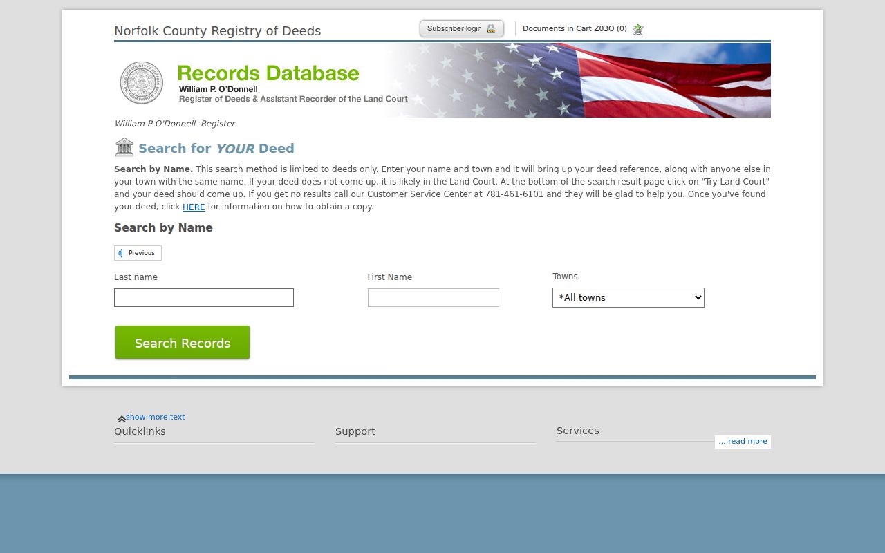
The form searches by last name, first name, and town rather than a regular street-address index, so an address is a cross-check rather than the primary key.
Braintree Street Deed Chain Checks
Norfolk County deeds are indexed by recorded parties and land-document information. The Registry's online search includes Braintree in its town selection and directs a researcher to consider Land Court when an expected result is absent. Recorded Land and Registered Land, also called Land Court, are separately indexed. Search the current Braintree owner as a grantee, compare the document type and date, then follow the prior reference found in a likely deed. A legal description can remain stable even if the Braintree street number changes.
A grantor is the party conveying an interest, while a grantee is the party receiving it. Those labels help trace a chain of title but do not state who occupied the property. The Registry's guide also says there is no ordinary property-address listing and that the address index is limited for documents before 2003. Staff help, historical books, maps, or a title professional may be needed for an older gap.
Registry images are free to view but carry the notation “Not An Official Copy.” The Registry lists $1 per page for an in-person copy and a mail fee of $2 for the first page plus $1 for each additional page per document. Request certification when the record needs official standing.
Note: Match town, party role, date, document reference, and parcel description before treating a same-name Registry result as the Braintree address.
Braintree Street Listings Mark a Date
The Braintree Town Clerk identifies the annual Resident Street Listing Book as the public-facing municipal street history layer. The Braintree January census and registration confirmation process also explains why the book is a dated administrative snapshot. If a response is not returned, an active voter can become inactive, but that process does not create a publicly searchable voter list by street. Massachusetts central-registry name and address information is not a general public record under M.G.L. c. 51, § 47C.
For a Braintree street directory question, request the particular year instead of assuming a new book answers an old address. A listing can support a careful statement that a name appeared at the address for that census cycle. It should then be compared with a parcel record, a deed, a historic directory, or another dated source. Polling places and precinct geography do not reveal a public roster of voters on the street.
Historic Braintree Street Directory Labels
Braintree's 1896 J. H. Hogan directory has a street list and resident or business entries. It is valuable because the printed pages can join a street and number to a name, a work description, a household notation, and a village marker. The volume is regional, however. B., S.B., E.B., P.O., Weymouth, and Quincy indicators must be transcribed with the entry. A street name alone is not enough to attach an older printed address to a modern Braintree parcel.
A separately cataloged Braintree reverse or criss-cross directory was not found. The substitute is the street-list section: begin with the street and number, collect the printed names, then read those names in the alphabetical section. This is a reverse-like method, but it should be called a street list rather than a distinct reverse directory.
The Braintree Historical Society Library & Archives holds maps and an assessor-map lead that can help when a historic number no longer fits the current street pattern. For a fuller reading of the historical printed volumes, use the Braintree city directory collections.
Braintree Street Permits and Changes
Braintree Building and Engineering records can answer questions that neither a deed nor an assessor card resolves. Braintree's Building Division describes permits, inspections, plans, correspondence, and public-record routes, but no public historical permit-search interface was located. Request a defined Braintree address, date range, and record type from the appropriate office. A permit date can show a project or inspection. It does not by itself establish when a person moved to the address.
Engineering handles addressing, parcel and zoning maps, abutters, building numbers, and scanned records. The department says it assigns new addresses and address changes, with a Street Number Application available in person or by email. Where a historic Braintree street number conflicts with a current map, ask for the address-change record and compare it with the legal description, historic atlas, and parcel identifiers.
Note: Treat a plan or permit as project evidence, then confirm any person-to-address connection with a separately dated source.
Braintree Street Research and Registry Numbers
Norfolk Registry's Q1 2026 report gives useful context for how much county title activity the Braintree street directory trail may encounter. The report lists 23,802 recorded documents and a 13 percent increase in average sale price. Those are Norfolk County aggregates, not results for one Braintree street, parcel, or household. They are best used as a reminder to preserve recording dates and document references rather than as a claim about a particular address.
The Registry has operated for more than 200 years, which helps explain why a Braintree title search may span modern images, earlier deed books, and a separate Land Court path. The activity report does not replace a deed-by-deed review. A Braintree street researcher still needs the correct party, Braintree town selection, document, and property description.
Braintree Street Directory Terms
Keeping Braintree record labels straight prevents a Braintree street search from overstating its evidence. The same Braintree address may be printed in a historic street list, displayed as a current situs on Patriot, and described by lot language in a recorded instrument. Preserve each label in the research notes instead of converting it to a single modern description.
- Parcel
- A tax and map unit used by the assessor and GIS. One parcel can have complex ownership or more than one unit.
- Situs address
- The physical location of the parcel. It is different from a tax bill's mailing address.
- Plat or parcel map
- A mapped depiction of land or lots. GIS parcel lines help research but are not a legal survey.
- Criss-cross directory
- A directory arranged by address. No separately cataloged Braintree title was found, so use printed street lists as the documented substitute.
Braintree Street Directory Limits
A Braintree street directory result cannot prove every person at an address. A Braintree assessor entry can name an owner of record while a tax mailing address belongs to a management contact, accountant, post-office box, or a different location. A Braintree deed records an interest in title. Braintree GIS draws a parcel. A historic Braintree directory or annual listing is dated. Each source can be strong evidence for its own purpose without becoming a complete picture of a household.
Some limits are explicit. The voter-status tool is an individual lookup requiring name, date of birth, residential ZIP, and an agreement checkbox, not a public street roster. Address Confidentiality Program participants may use a substitute address in public records, while their actual address remains protected except for specified legal needs. When a match remains uncertain, leave it unresolved and ask the custodian about the correct access route.